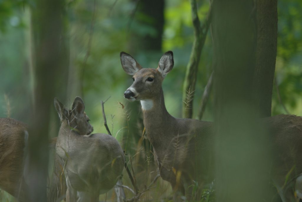
Deer Monitoring
Why are we capturing deer?
There are two reasons to tag and radio-collar deer on the study areas:
- Estimate annual harvest rates
- Monitor changes in deer populations over time
Capturing and tracking deer
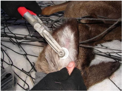
Deer are captured using Clover traps and rocket nets. Six adult does and four adult bucks will be fitted with satellite GPS Collars on each study area. Deer not fitted with radio-collars will receive ear tags with a $100 reward for hunters to report the harvest of the deer. No rewards are paid for harvesting radio-collared deer. Trapping will be conducted each winter (January–April) of the study.
The GPS collars collect 5 locations per day. Locations are transmitted via email and uploaded to a database so field technicians can monitor movements and recover the radio-collar if necessary.
Estimating harvest rates
Radio-collared deer allow us to estimate the proportion of deer that survive from the time of capture to the hunting season. This information, in combination with data on the ear-tagged deer that are harvested, provides the means for estimating the proportion of deer harvested on the study area. This methodology was developed as part of a M.S. Thesis by Frances Buderman at Penn State University under the direction of Dr. Duane Diefenbach.
Monitoring deer populations over time
Deer populations will be monitored over the course of the study using state-of-the-art techniques.
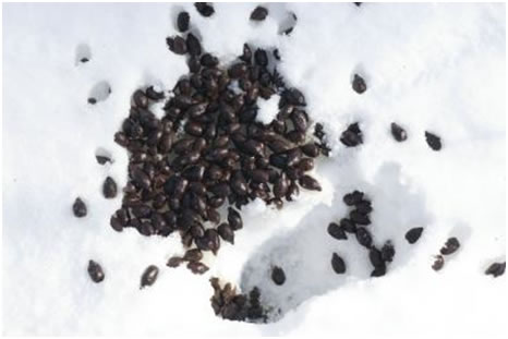
We are using 2 methods to monitor deer abundance. First, hundreds of transects across the study areas will be walked and deer pellets collected in April. These deer pellets can be analyzed using genetic techniques to individually identify deer. This is just like capturing and marking a deer with an ear tag, except we are using their DNA as a unique marker. These “mark-recapture” data will allow us to estimate deer density.
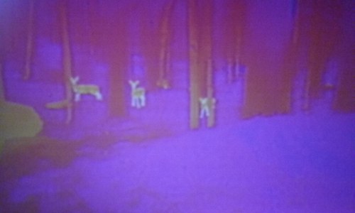
Also, we are using distance sampling with FLIR (forward-looking infrared) technology to count deer along roads. By recording how far deer are detected from the road we can account for the fact that the farther a deer is from a road we are less likely to detect it. However, roads do not provide a representative sample of the study area. For example, deer are less likely to occur near a road, and roads are less likely to occur on steep slopes.
To adjust for the fact that roads are not representative of the study area, we use the GPS location data of our collared deer to estimate how deer are distributed relative to roads. This information can be used to correct our counts along roads and obtain an accurate estimate of deer density.